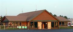
KEGV - Eagle River Union Airport ... Eagle River, WI, US
| Lat / Long: | 45.93233, -89.26828 |
| Lights: | SSSR |
| Elevation: | 1642 FT |
| U.S. Customs: | No |
| Time Zone: | America/Chicago UTC -6 (-5 DST) |
| Time: | 02:32 AM [0732 UTC] |
| Tower: | No |
| Daylight Savings: | Yes Mar 09 - Nov 02 |
Eagle River Union Airport


| Fuel Prices | |
|---|---|
| Jet-A | 5.15 |
| 100LL | 5.25 |
| AM Preferred Discount | No |
| Ramp Fee waived | Yes with 100 gal. |
| Contact | |
|---|---|
| Phone | 715-479-7442 |
| FAX | |
| [email protected] | |
| Website | www.erairport.com |
| Hours | |||
|---|---|---|---|
| M | 08:30 AM - 05:00 PM | F | 08:30 AM - 05:00 PM |
| T | 08:30 AM - 05:00 PM | S | 08:30 AM - 05:00 PM |
| W | 08:30 AM - 05:00 PM | Su | 08:30 AM - 05:00 PM |
| Th | 08:30 AM - 05:00 PM | ||


Pilot Lounge
Weather
WiFi
We now have self serve Jet A and 100LL 24 hours a day - $0.50/gallon less than full service.
Pre-mixed Prist, For after hour service call 715-479-7442 - on call personnel phone number listed on voice mail message.
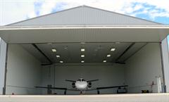
Facility Fees waived with fuel purchase - 100 gallon min. Overnight fee waived with fuel purchase - no minimum. Weekly, Monthly rates available. Heated Hangar space available - 60' x 70' 19' 6" tail height.
ColtEPICEverestWestern PetroleumWorld Fuel


Airports Nearby KEGV
| Airport | Distance mi | Distance km | Runway ft | Runway m | Best JetA | Best 100LL | |
|---|---|---|---|---|---|---|---|
| KEGV | Eagle River Union | 0 mi | 0 km | 5000 ft | 1524 m | $5.15 | $5.25 |
| K40D | Three Lakes Muni | 12 mi | 19 km | 3400 ft | 1036 m | -- | -- |
| KLNL | Kings Land O Lakes | 15 mi | 25 km | 4000 ft | 1219 m | -- | $6.10 |
| WI36 | Dolhun Field | 18 mi | 29 km | 2700 ft | 822 m | -- | -- |
| KARV | Lakelandnoble F Lee Memorial Field | 22 mi | 35 km | 5150 ft | 1569 m | $5.39 | $5.29 |
| WI42 | Pine Grove | 22 mi | 36 km | 3000 ft | 914 m | -- | -- |
| KRHI | Rhinelander-Oneida County | 22 mi | 36 km | 6800 ft | 2072 m | $5.20 | $5.29 |
| KBDJ | Boulder Junction | 23 mi | 37 km | 3170 ft | 966 m | -- | -- |
| WS39 | Pinewood Air Park | 24 mi | 40 km | 2722 ft | 829 m | -- | -- |
| 72MI | Northwoods | 24 mi | 39 km | 5000 ft | 1524 m | -- | -- |
Arrivals Per 365 Days
| KEGV Airport | 23 |
| Eagle River Union Airport | 23 |
This information is only a sample of the arrivals scheduled in AirplaneManager.com scheduling software
and is not representative of data/information from the FAA or aviation industry.

