KXWA - Williston Basin International Airport Airport ... Williston, ND, US
| Lat / Long: | 48.15390, -103.45040 |
| Lights: | None |
| Elevation: | 2350 FT |
| U.S. Customs: | 7018752129 |
| Time Zone: | America/Chicago UTC -6 (-5 DST) |
| Time: | 02:03 AM [0703 UTC] |
| Tower: | Yes |
| Daylight Savings: | Yes Mar 09 - Nov 02 |
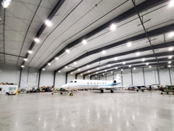
Overland Aviation - Preferred FBO


| Fuel Prices | |
|---|---|
| Jet-A | 6.39 |
| 100LL | 6.29 |
| AM Preferred Discount | Yes |
| Ramp Fee waived | Yes with 100 gal. |
| Contact | |
|---|---|
| Phone | (701) 875-4334 |
| FAX | (701) 875-4337 |
| [email protected] | |
| Website | www.overlandaviation.com |
| Hours | |||
|---|---|---|---|
| M | 07:00 AM - 07:00 PM | F | 07:00 AM - 07:00 PM |
| T | 07:00 AM - 07:00 PM | S | 8:00 AM - 05:00 PM |
| W | 07:00 AM - 07:00 AM | Su | 8:00 AM - 05:00 PM |
| Th | 07:00 AM - 07:00 AM | ||


Maintenance
Customs
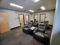
Pilot Lounge
Restaurant
Weather
WiFi
FBO Services available 24/7/365. Facility Fee waived with purchase of fuel minimum if utilizing services and/or FBO facility. Please contact us for applicable Facility Fee and Fuel Minimum for your aircraft type. No Landing Fees, No Infrastructure Fees, No Security Fees. For After-Hours Services, please call 701-570-5345. A $175 Call-Out fee applies.
AEGAvFuelChevronColtEPICEverestEVOPhillipsSignatureTitanUV AirWorld Fuel


Airports Nearby KXWA
| Airport | Distance mi | Distance km | Runway ft | Runway m | Best JetA | Best 100LL | |
|---|---|---|---|---|---|---|---|
| KXWA | Williston Basin International Airport | 0 mi | 0 km | 7500 ft | 2286 m | $6.39 | $6.29 |
| ND23 | Wright Fld | 8 mi | 13 km | 2800 ft | 853 m | -- | -- |
| 4NA1 | Ring Rock Ranch | 12 mi | 19 km | 2000 ft | 609 m | -- | -- |
| 4NA0 | Lindvig Airstrip | 11 mi | 19 km | 1800 ft | 548 m | -- | -- |
| NA18 | Hought Airstrip | 25 mi | 40 km | 2000 ft | 609 m | -- | -- |
| KS25 | Watford City Muni | 26 mi | 42 km | 4402 ft | 1341 m | $5.44 | $6.15 |
| 5ND0 | Stiehl | 27 mi | 44 km | 1600 ft | 487 m | -- | -- |
| 4NA6 | Nicks Landing | 28 mi | 46 km | 2000 ft | 609 m | -- | -- |
| NA92 | Roy Lohse | 29 mi | 47 km | 2275 ft | 693 m | -- | -- |
| KD60 | Tioga Muni | 29 mi | 48 km | 5102 ft | 1555 m | -- | -- |
Arrivals Per 365 Days
| KXWA Airport | 58 |
| Overland Aviation | 58 |
This information is only a sample of the arrivals scheduled in AirplaneManager.com scheduling software
and is not representative of data/information from the FAA or aviation industry.


