KAOH - Lima Allen County Airport ... Lima, OH, US
| Lat / Long: | 40.70748, -84.02708 |
| Lights: | DawnDusk |
| Elevation: | 975 FT |
| U.S. Customs: | No |
| Time Zone: | America/New_York UTC -5 (-4 DST) |
| Time: | 03:49 AM [0749 UTC] |
| Tower: | No |
| Daylight Savings: | Yes Mar 09 - Nov 02 |
Allen County Regional Airport Authority


| Fuel Prices | |
|---|---|
| Jet-A | 5.25 |
| 100LL | 5.50 |
| AM Preferred Discount | No |
| Ramp Fee waived | Yes with 100 gal. |
| Contact | |
|---|---|
| Phone | 419-227-3225 |
| FAX | |
| [email protected] | |
| Website | www.allencountyairport.com |
| Hours | |||
|---|---|---|---|
| M | 08:00 AM - 5:00 PM | F | 08:00 AM - 5:00 PM |
| T | 08:00 AM - 5:00 PM | S | 09:00 AM - 4:00 PM |
| W | 08:00 AM - 5:00 PM | Su | 01:00 PM - 5:00 PM |
| Th | 08:00 AM - 5:00 PM | ||


Pilot Lounge
Weather
WiFi
24 Hour Terminal Lobby Access Available, Enjoy! Jet Fuel premixed. After hour callouts available, call for details.
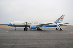
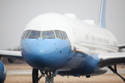
Fees waived with 100 gallon Jet Fuel purchase. Corporate Hangar space 100x120x20 available. Rent your spot today! Call us and save 419-227-3225 Catering everything from a C150 to Air Force One!
World Fuel


Airport Services Information
| Service | Type | Phone | Website | |
|---|---|---|---|---|
| Allen County Regional Airport | General | 419-227-3225 | [email protected] | www.allencountyairport.com |
Airports Nearby KAOH
| Airport | Distance mi | Distance km | Runway ft | Runway m | Best JetA | Best 100LL | |
|---|---|---|---|---|---|---|---|
| KAOH | Lima Allen County | 0 mi | 0 km | 6000 ft | 1828 m | $5.25 | $5.50 |
| OH91 | Dave Rice | 10 mi | 17 km | 1250 ft | 381 m | -- | -- |
| K0D7 | Ada | 11 mi | 19 km | 1954 ft | 595 m | -- | -- |
| K5G7 | Bluffton | 14 mi | 23 km | 4125 ft | 1257 m | -- | -- |
| K6C2 | Ohio Dusting Co Inc | 17 mi | 27 km | 3112 ft | 948 m | -- | -- |
| OI66 | Eibling Circle E | 18 mi | 30 km | 2300 ft | 701 m | -- | -- |
| 3OH6 | Youngpeter | 18 mi | 29 km | 2460 ft | 749 m | -- | -- |
| KAXV | Neil Armstrong | 20 mi | 33 km | 5500 ft | 1676 m | $4.53 | $5.31 |
| KI95 | Hardin County | 21 mi | 34 km | 4797 ft | 1462 m | -- | -- |
| 1OH4 | Fortman | 21 mi | 35 km | 0 ft | 0 m | -- | -- |
Arrivals Per 365 Days
| KAOH Airport | 12 |
| Allen County Regional Airport Authority | 12 |
This information is only a sample of the arrivals scheduled in AirplaneManager.com scheduling software
and is not representative of data/information from the FAA or aviation industry.

